

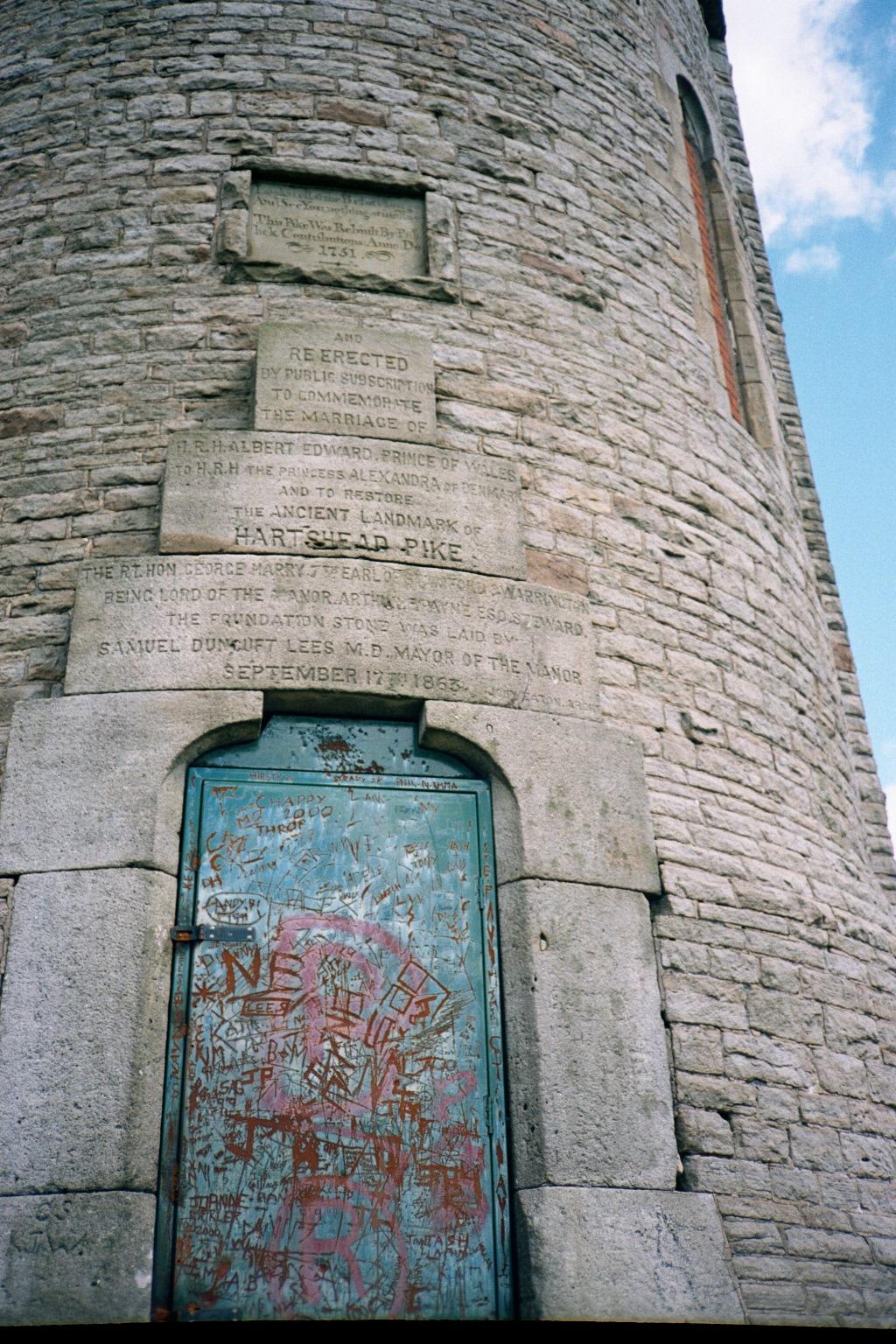
Hartshead Pike is a very old monument, re-rerected in 1751. The top pane which is too small to read in the caption says:
Look at me afore ye go, And see you nothing at me throw.
THE BEACONS
Hartshead Pike. The hill, called "Hartshead", which rises amongst the line of Pennine foothills which form Ashton-Under-Lyne's north-eastern border, is not the highest of the group. It's height is actually no more than 925 feet, whereas it's neighbour to the immediate north-east, Brown Edge, reaches 1008 feet at it's highest point. To the north again, and over on the other side of the River Tame, the greatest hills spread out like a fan from the borders of Ashton's old parish. Yet, as Mr George Whittaker wrote, "There is something in it's [Hartshead's] position which enables it to be seen from a long distance ................... It has, from earliest times, been selected as a beacon in preference to the higher hills near it. The lines which Aamon Wrigley wrote of "Pastures" in Saddleworth, might equally be written of Hartshead:
If you stand out east of Pastures and look downwards o'er land, You have got four English counties in the hollow of your hand. There is Lancashire and Cheshire and the mountains of the Peak, The brave strong hills of Yorkshire that battle for the weak."
We do not know whether Harshead was always a beacon hill. In pre-Roman times it may well have been a height for sun worshipping or for astrological calculation. FT Stubbs, of Oldham, gave good reason for supposing that the beacon hill of "Bucton Castle", lying almost opposite Hartshead across the river, may have been used in past ages as a temple for sun-worshipping and a solar observatory. He had noted that many stone circles were placed "not on hill tops but in places giving a view of the sun at the summer solstice, rising above conspicuous features of the landscape". He names Alphin as the critical point on the horizon which (from Bucton Castle) is the point of sunrise on the longest day, so that a very definite purpose is suggested by the idea that Bucton became a peak of importance as being the point marking one end of a solar sighting line. (On June 21st 1951, the author made an effort to test this theory in regard to Hartshead, and found that when standing on the original site of the beacon - now marked by mill-stones from the Maryland's old sand mill- a straight line from this spot to the point of sunrise on that day passed through the meeting place of the three old paths near the "Collier's Arms" inn and ran straight across over Brown Edge to the stone marking the Ordnance Survey datum line at the Edge's highest point, from behind which stone - although the latter is, of course, not visible from the Pike - the sun had appeared to rise.) Souther Causeway is said to be an old Celtic way leading up to Brown Edge and Hartshead, the lane from Hartshead Pike to Mossley Cross being it's Celtic continuation towards Bucton castle. According to a well- known writer, the adjective "Brown" seems to have been commonly attached to hills and high ridges which the ancient peoples probably used in their solar calculations - "Brown Willy" in Cornwall, being an example of this practise. The Romans, in their turn, are said to have used Hartshead as a signalling station. From it's summit could be seen and controlled large sections of three Roman roads, ie the great Iter or trunk road from York to Chester, the road from their camp at Melandra which ran via Bucton to Castleshaw, and the branch of this road known as "Staley Street"' which broke away from the latter to run over Ridgehill and Luzley. Doubtless the Romans made good use of our hill's more distant view-points, for, before the atmosphere grew smoke-laden, through industry, Haslingdon, and Pendle Hill near Clitheroe, were visible from Hartshead summit.
©Antony Lambert